
Arrigetch Peaks
Tasmanian Packrafters in the Brooks Range, Alaska; Alatna River and Arrigetch Peaks
John McLaine
Matt Brain
Pete Culhane
July 2014
Part 2: Side Trip to the Arrigetch Peaks.
(For Part 1, please visit this page.)
The Arrigetch Peaks area of the Brooks Range is one of the most spectacular and beautiful mountain areas in North America, so despite its difficulty of access, small groups of people sometimes fly in to visit the region, by float plane to Circle Lake. Our river campsite was only a few kilometres from Circle Lake, so there was a fair expectation that we might bump into some other people in this region. We left our boats and paddling gear tied to trees in the riparian zone of the lower Arrigetch Creek near its junction with the Alatna River. With a flexible plan and a week’s food, we were excited to be heading overland to the peaks. Unfortunately we had no mountaineering equipment with us, and at such a distance from emergency services, our scrambles would of course be very conservative. No undue risk-taking was on our agenda. Check out what we got up to:
Day 6.

If Matt looks excited, it’s because he loves this stuff! We planned to walk up the Arrigetch valley in the central distance. Ahead are Alder thickets of renown. Alder is apparently amongst the most challenging scrub America has to offer… but it’s oh so cruisy compared to Tasmanian scrub. Easy Street!

Pete looking back across the vast Alatna valley.

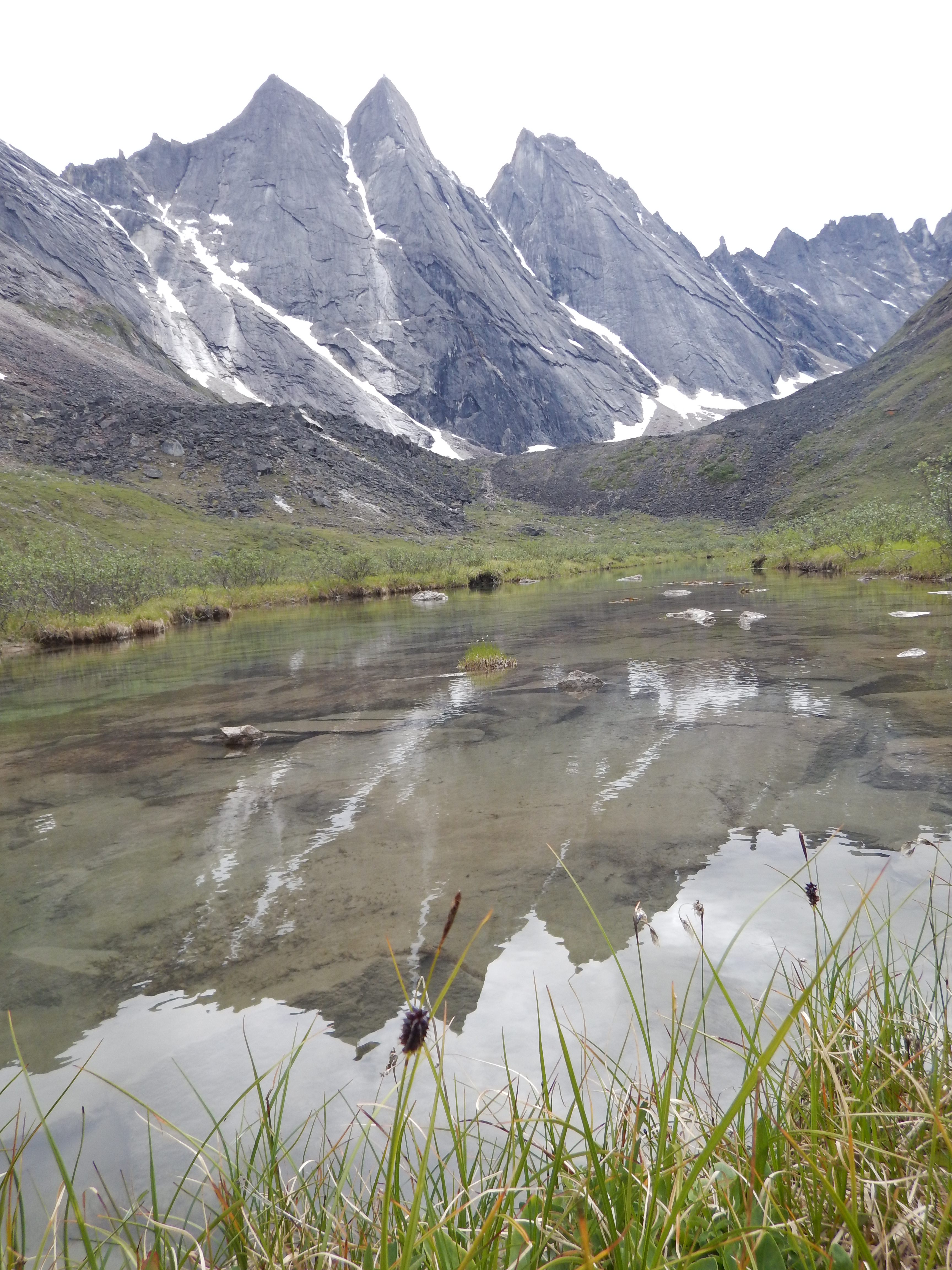
As we crested the first scrubby ridge for views of the Arrigetch Peaks, we could barely contain our excitement. These peaks are impressive!

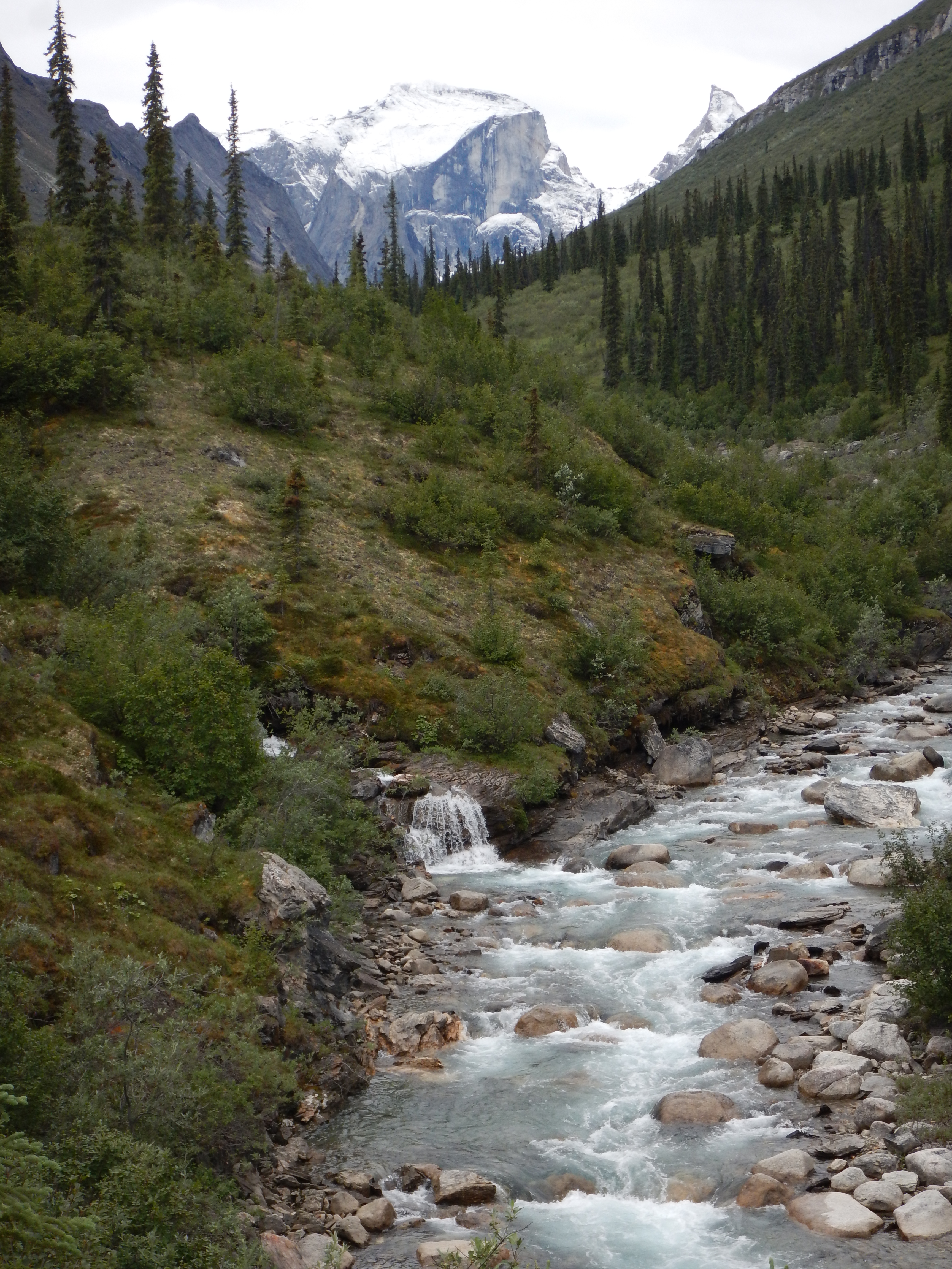
The Arrigetch Creek is big enough to paddle, at grade 2/3 with occasional grade 4. Although we simply walked past it both ways, Roman Dial and his friends have paddled it.
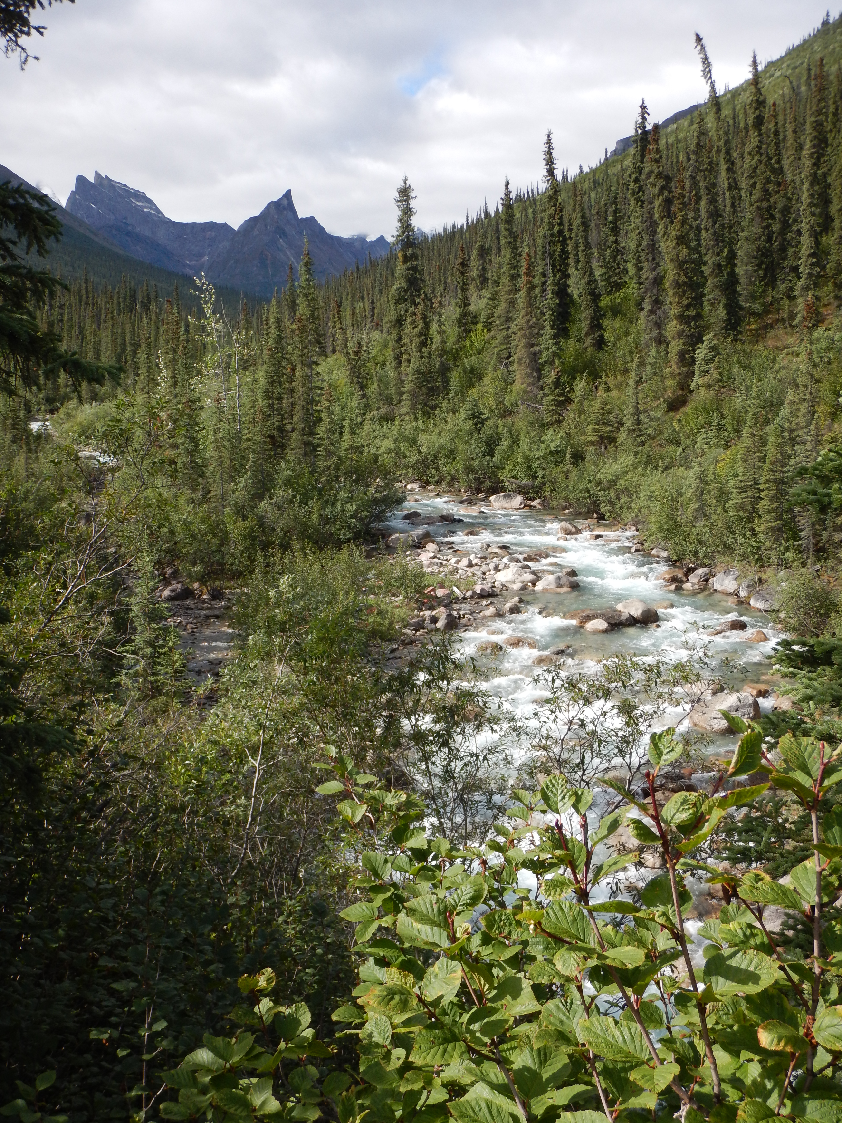
As we walked further upstream, the head of the Arrigetch valley continued to entice.
Since the 1970s, climbers have named most of the peaks in the Arrigetch. Apart from a few of the larger peaks, I was happy for them to remain unnamed in my mind. Matt made the effort to learn all of their names so he could cross-reference the different views of them from adjacent valleys.
I’m no botanist, but I’d guess this belongs to the genus geum, and it reminds me of the Tasmanian alpine geum plants, half a world away.

Getting closer to the big peaks. It was a long walk, taking most of a day. We picked up a rough wombat track half way. I think Alaska has quite impressive wombats, judging by their footprints.

A huge mound of wombat poo. Or maybe it was bear… who’s to say?

Can you imagine the building excitement as these peaks continued to emerge?

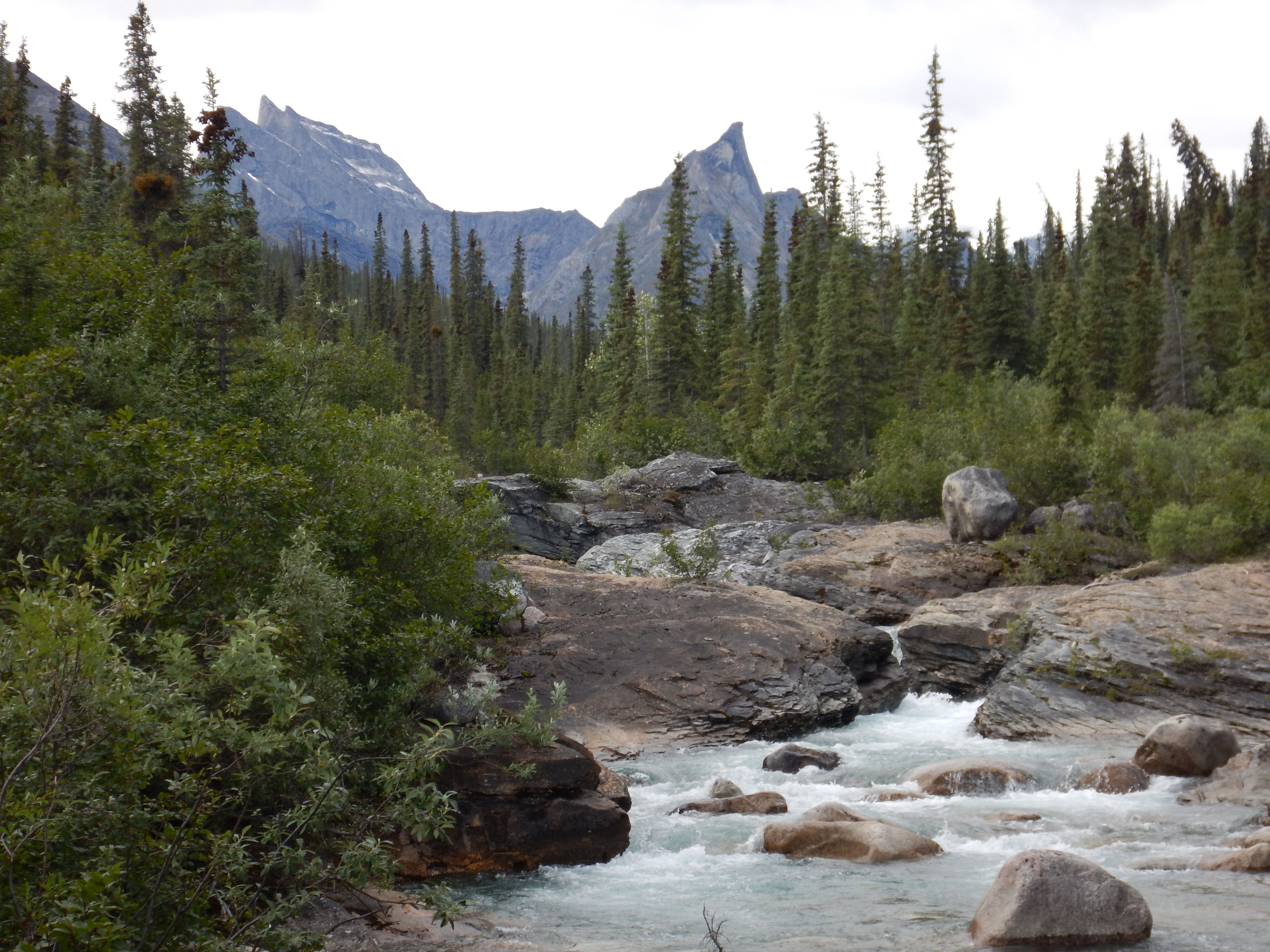
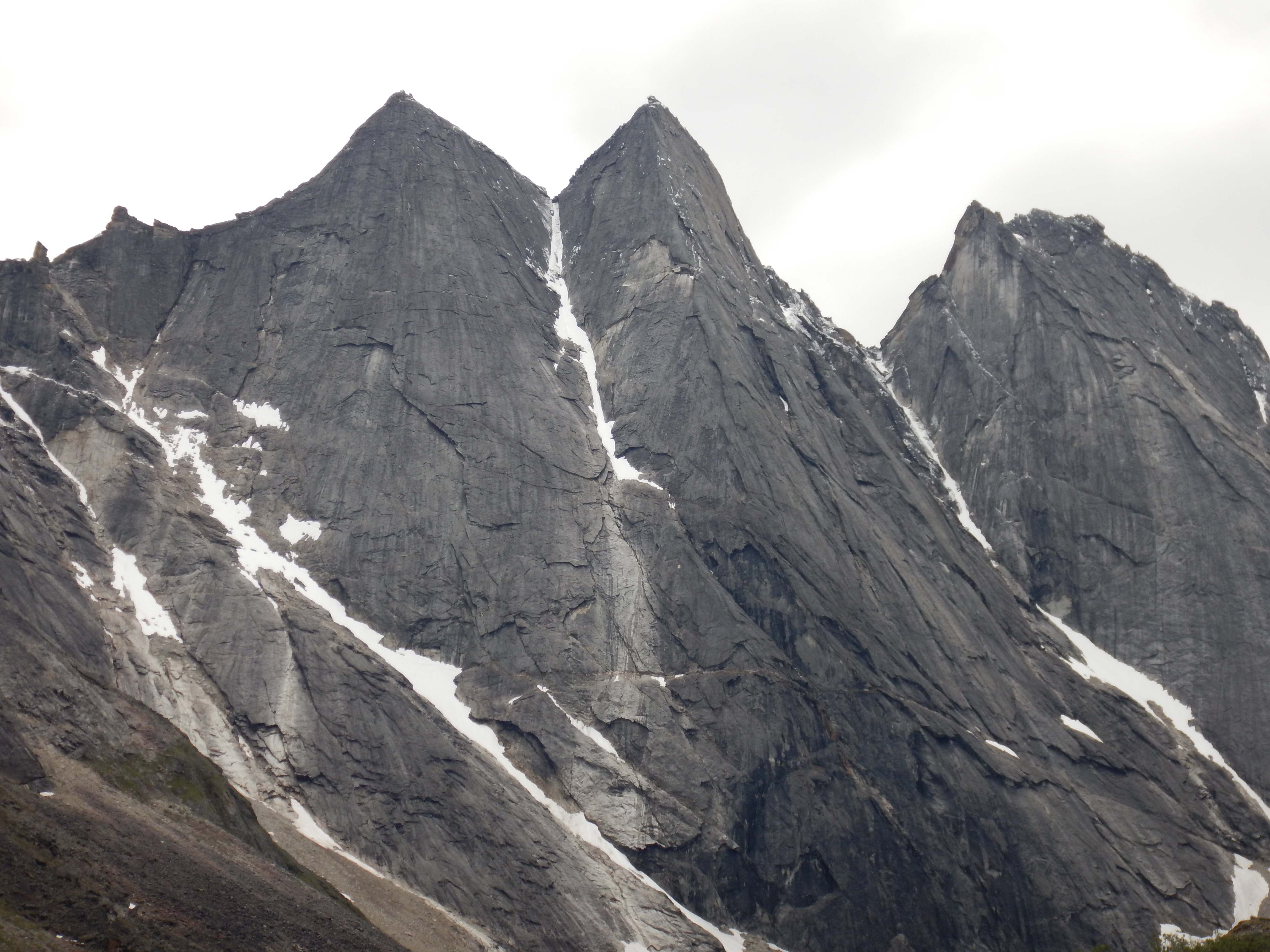
This lump of granite is known as Xanadu, and dominates the head of the Arrigetch valley.
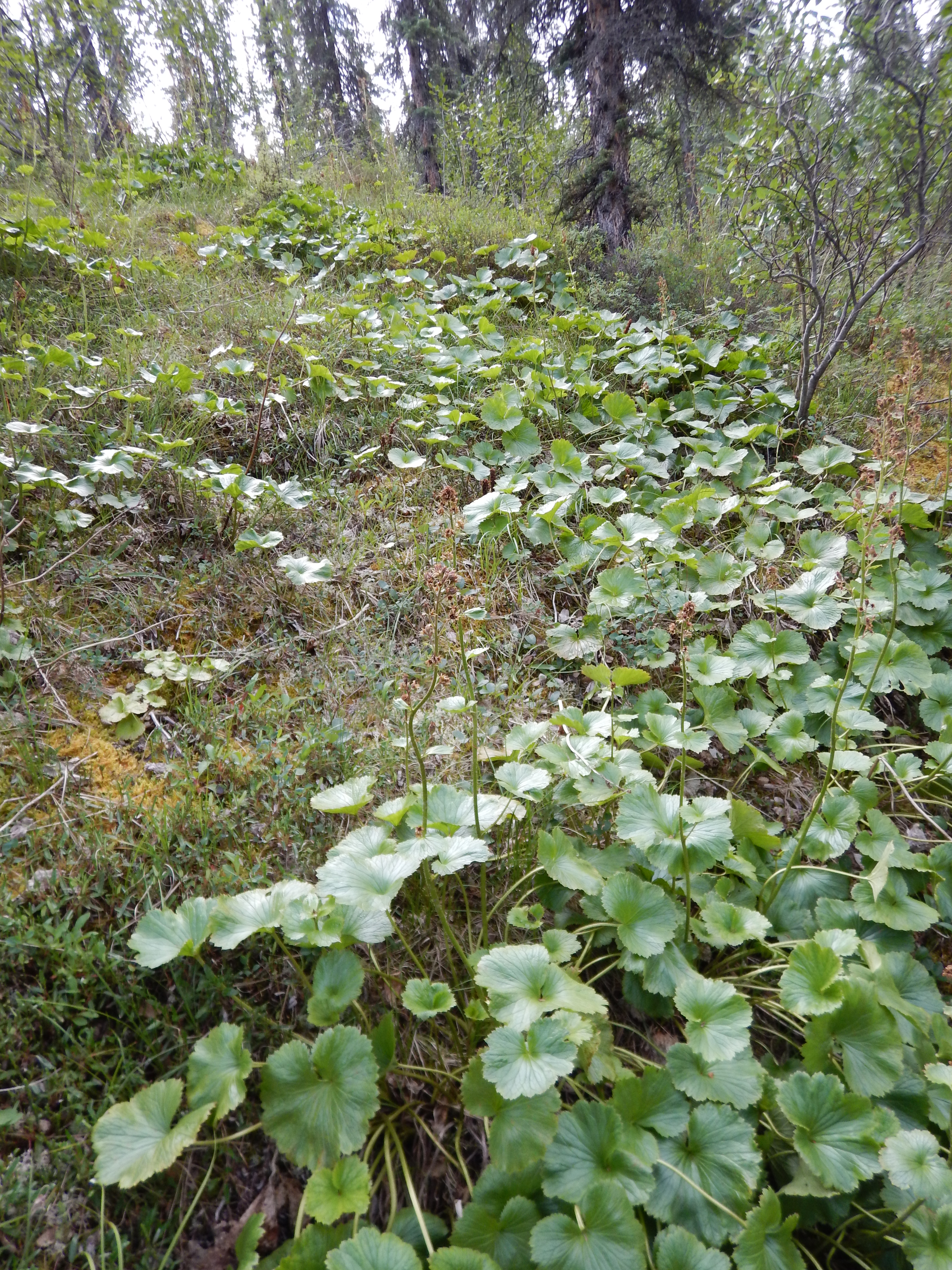
The groundscape underfoot was just as exquisite as the grand vistas overhead.
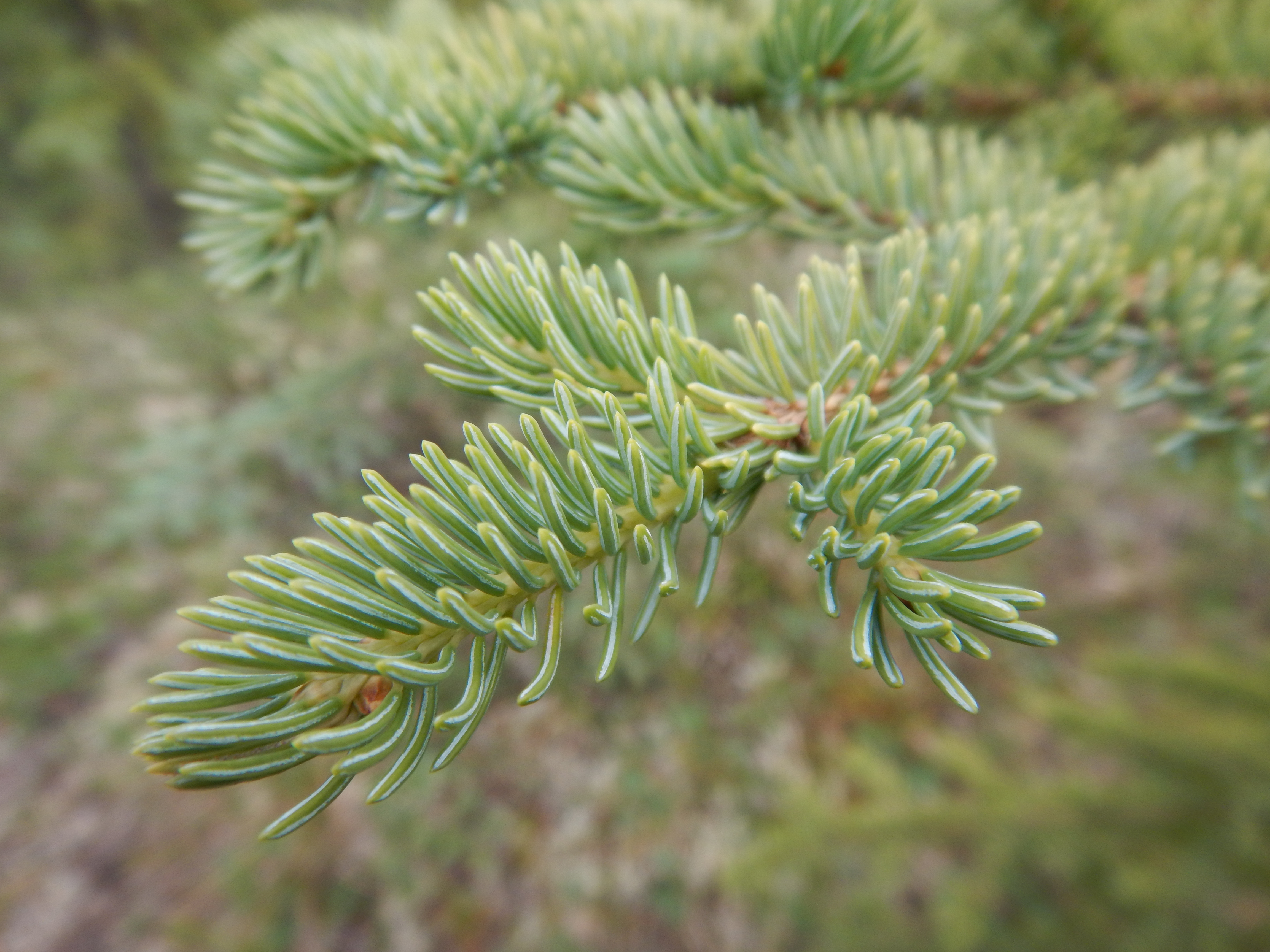
This is a detail of a Spruce tree. These are cool. You almost imagine that you are surrounded by Tasmanian Pencil Pines, and although they are distinctly different, you still feel like you are walking amongst old friends when you walk amongst the Spruce.
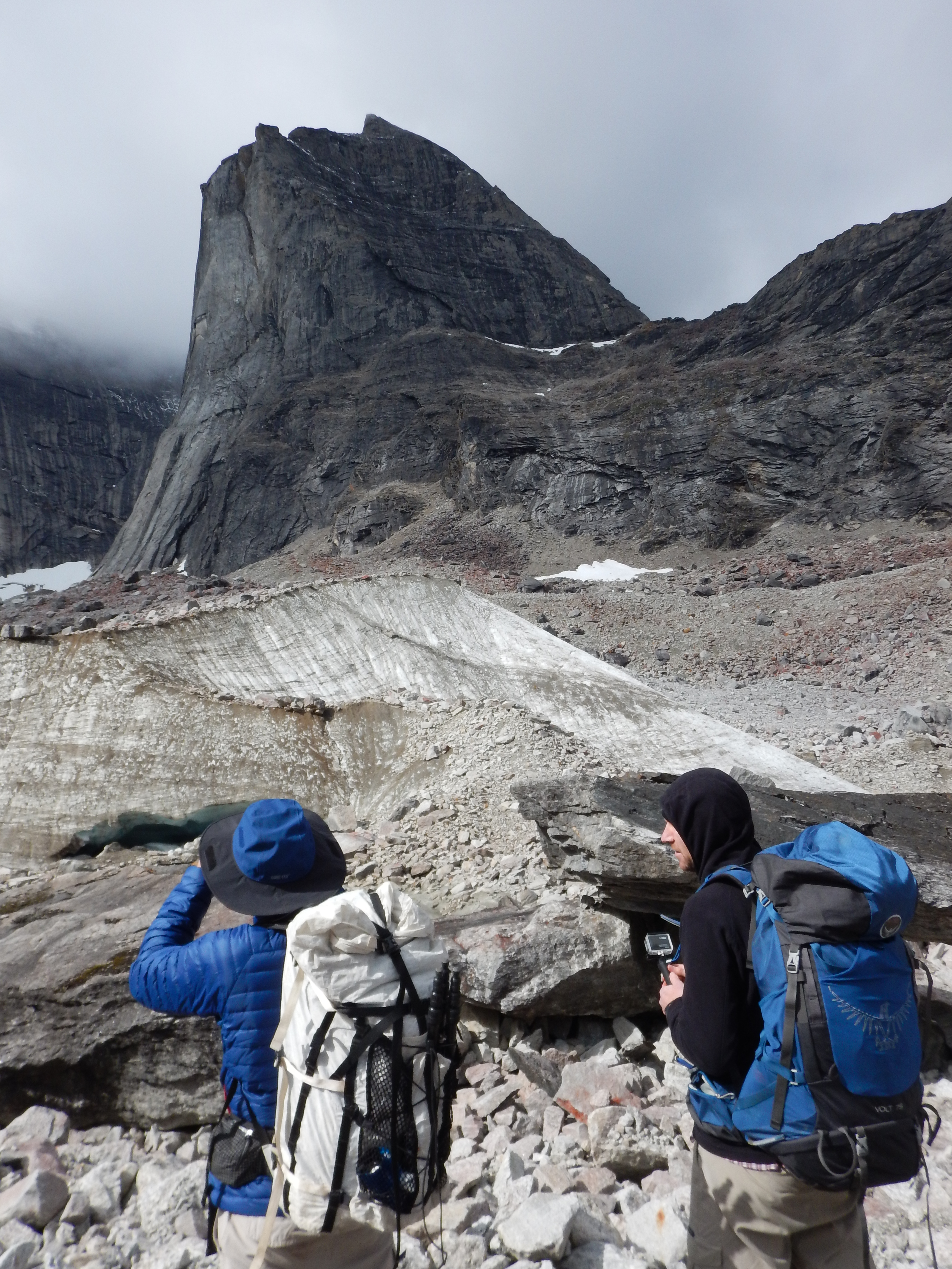
The sharp peak emerging at right is Ariel, which is apparently a dramatic but achievable scramble most summers. Matt scouted it, but found that the last quarter of the summit ridge was ice-bound. Without crampons or ice-axes with which to self-arrest, it was too risky to ascend at this time, unfortunately.

Xanadu and Ariel.
When approaching the big peaks, their grandeur and simplicity became almost overwhelming.
The eastern branch of the Aquarius valley. Caribou.

Caribou. During the summer months most of the caribou are grazing on the north slope. They will walk back through these mountains and valleys in the autumn and spend winter in the snow-laden forests of the southern flanks of the Brooks Range. This caribou is quite skinny; it probably won’t make it to the wintering grounds this year.
The Maidens

A beautiful alpine meadow, in what was likely once a tarn in millennia past.

Alaskan wildflowers. I didn’t know what this was when I first found it in a small alpine wetland area. Later researched revealed its common name to be Monkshood. Highly toxic, apparently.
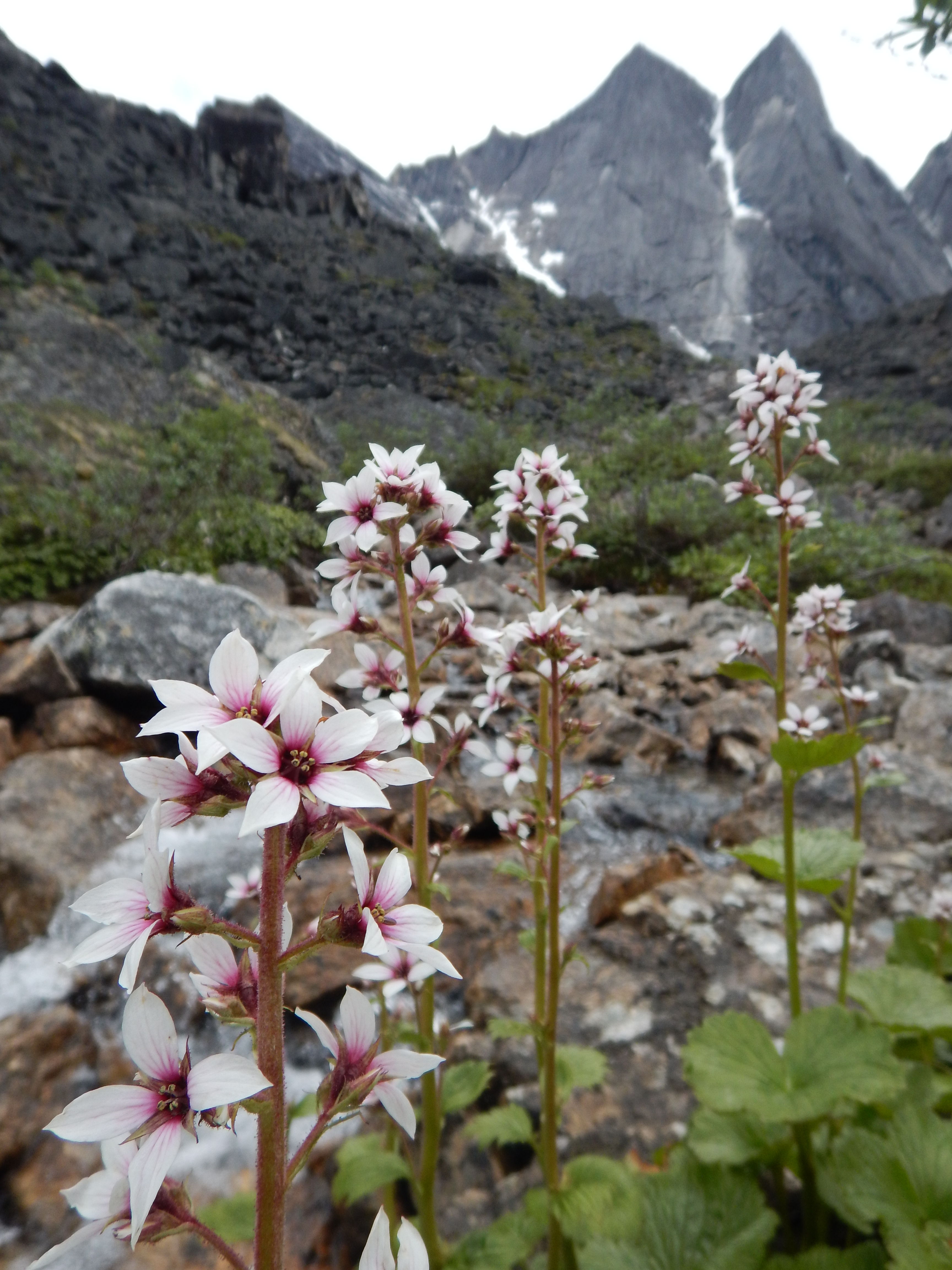
Wish I knew what these sweet flowers were.

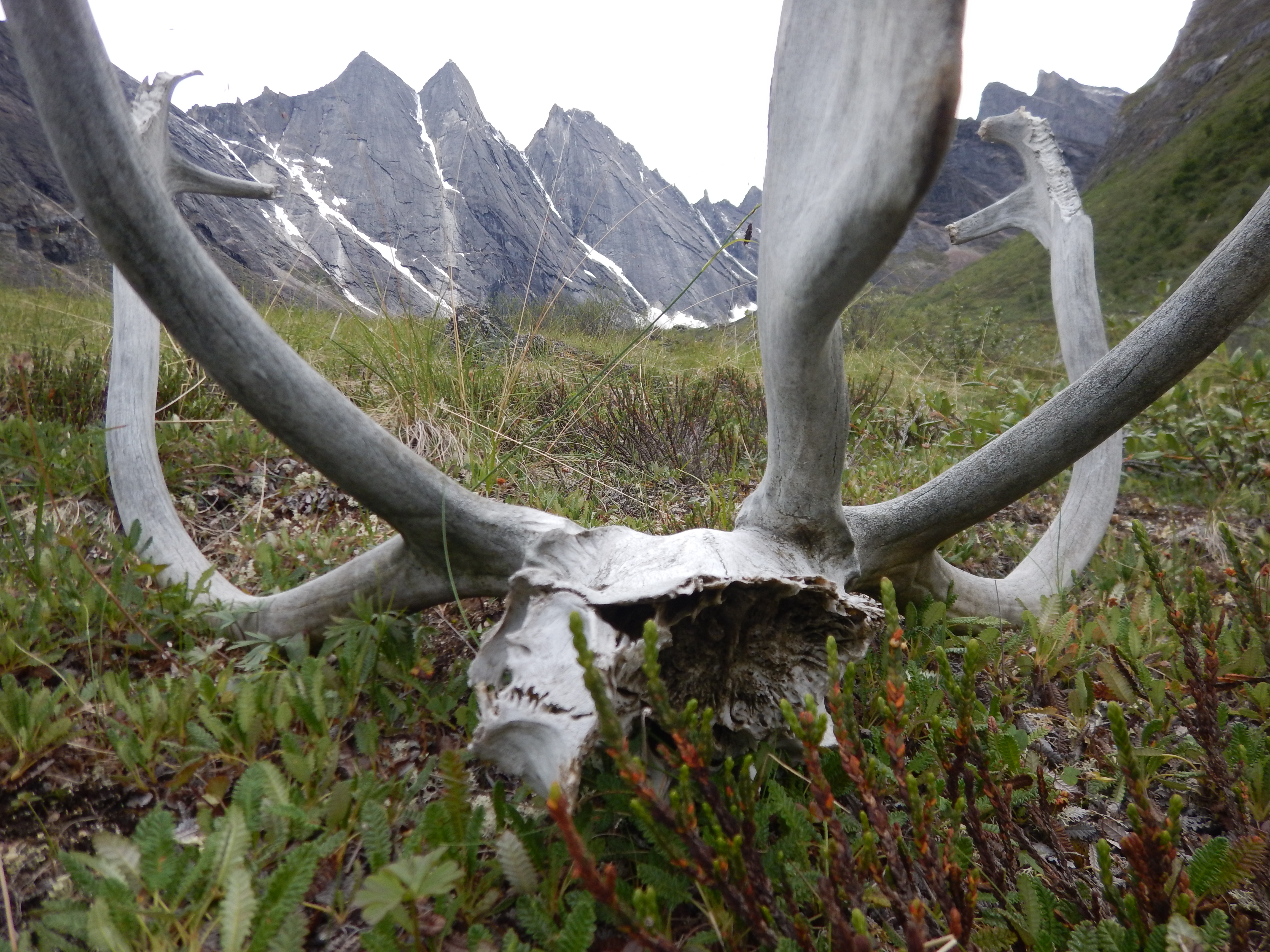
Another irresponsible caribou; been leaving its detritus around. Appaently the smaller mammals such as gound squirrels, love to come along and gnaw these shed antlers.

Antler near camp.
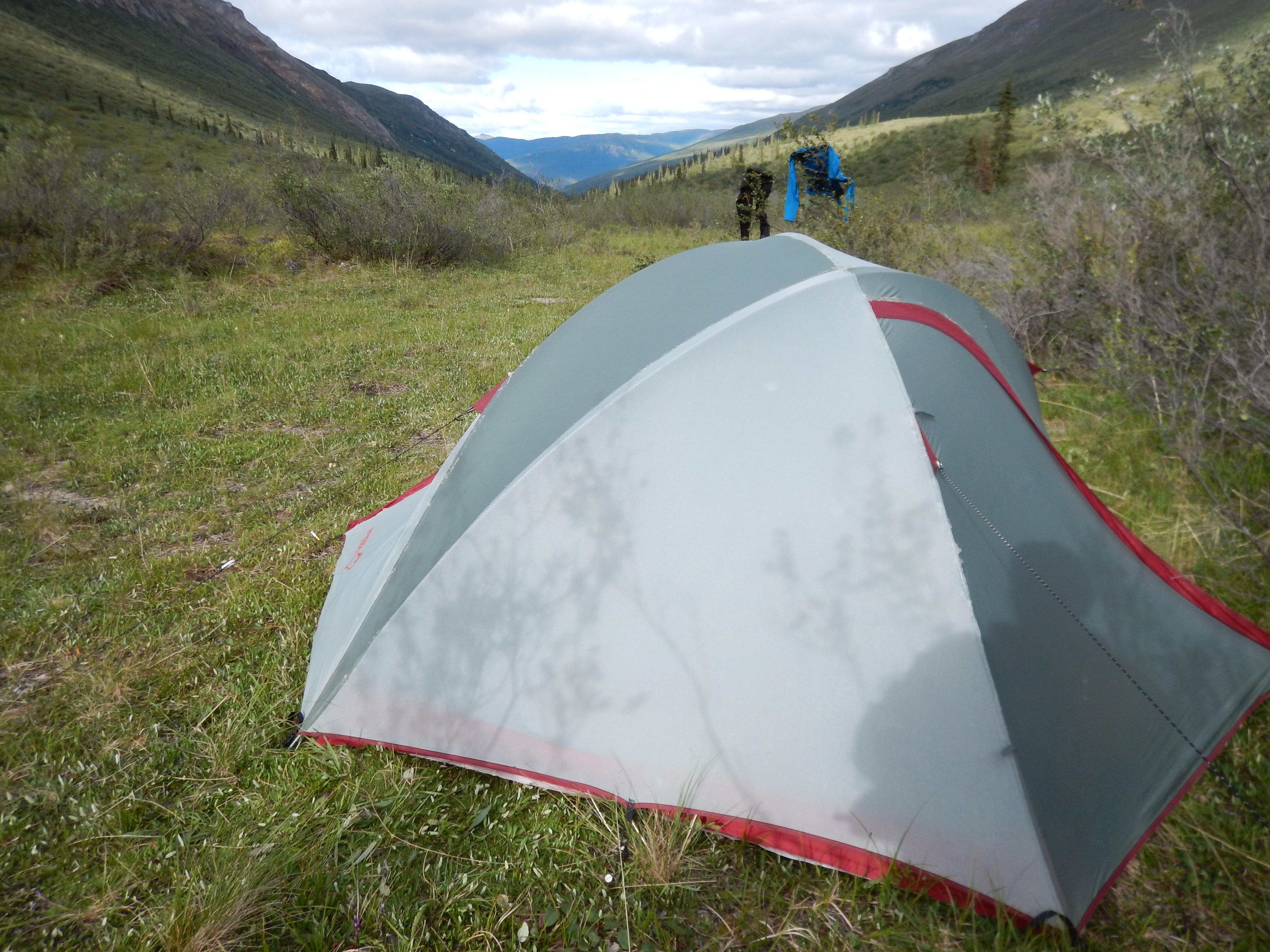
Our campsite for Day 6 and Day 7. We camped in a beautiful natural clearing near the junction of the upper Arrigetch and Aquarius valleys, enabling us to explore the upper Arrigetch valley with day packs on Day 7.

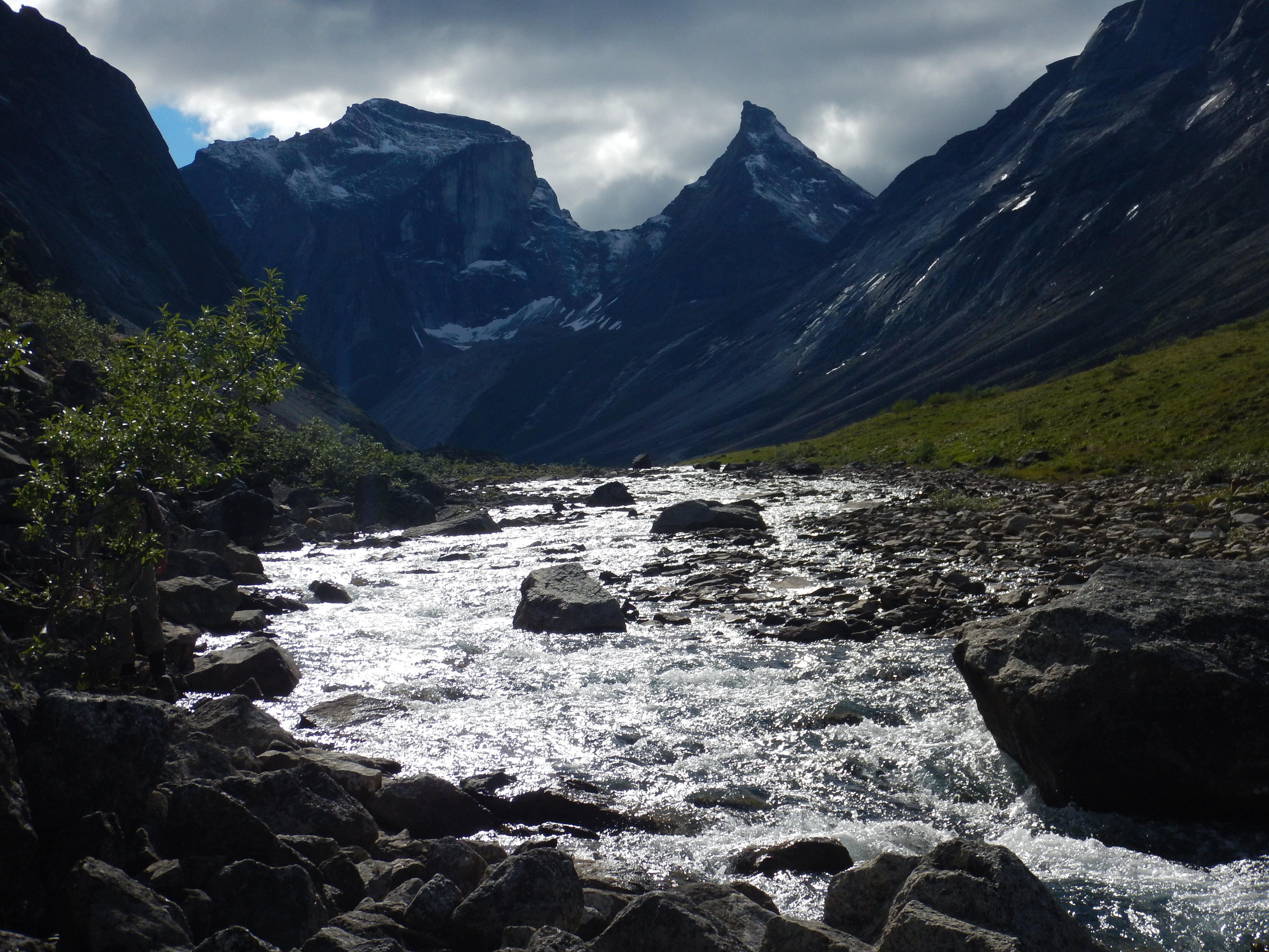
Upper Arrigetch Creek

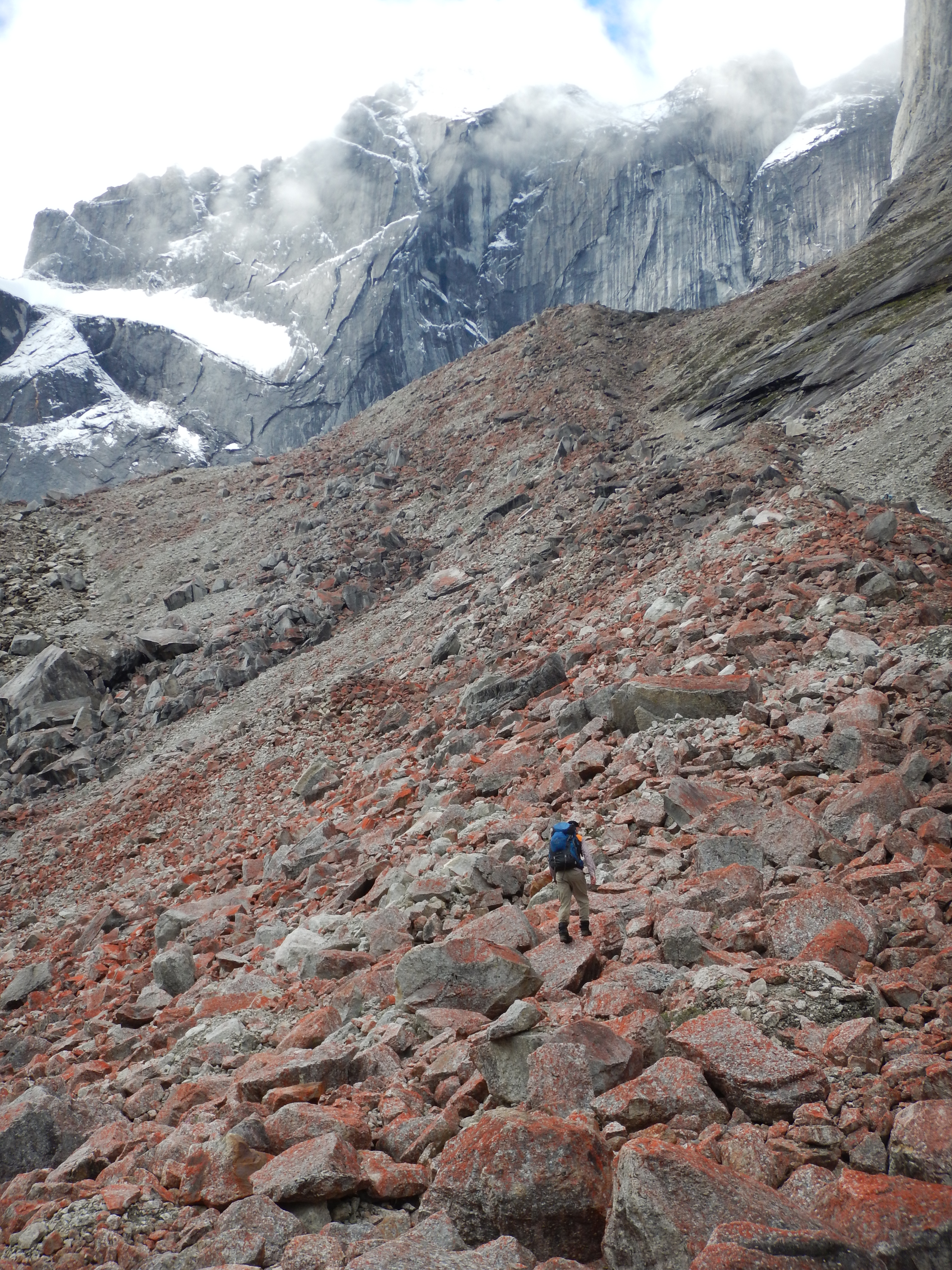
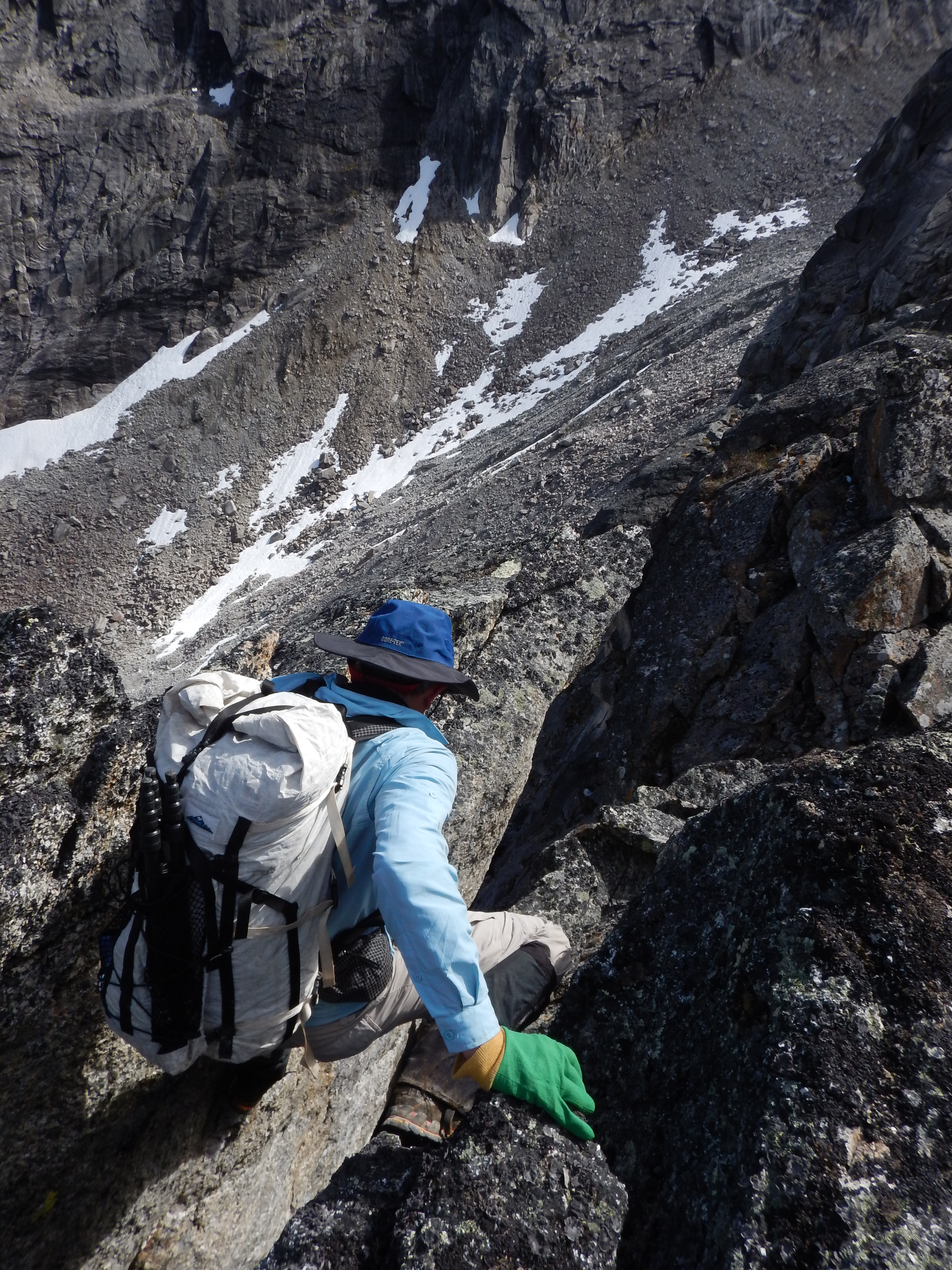
There was lots of talus or scree hopping, so familiar to us from our dolerite hopping back home in Tasmania. Despite the fact that we felt very comfortable on this stuff, quite a lot of it was loose and it had to be traversed carefully.

A cool little waterfall descending the north-western flank of the valley.

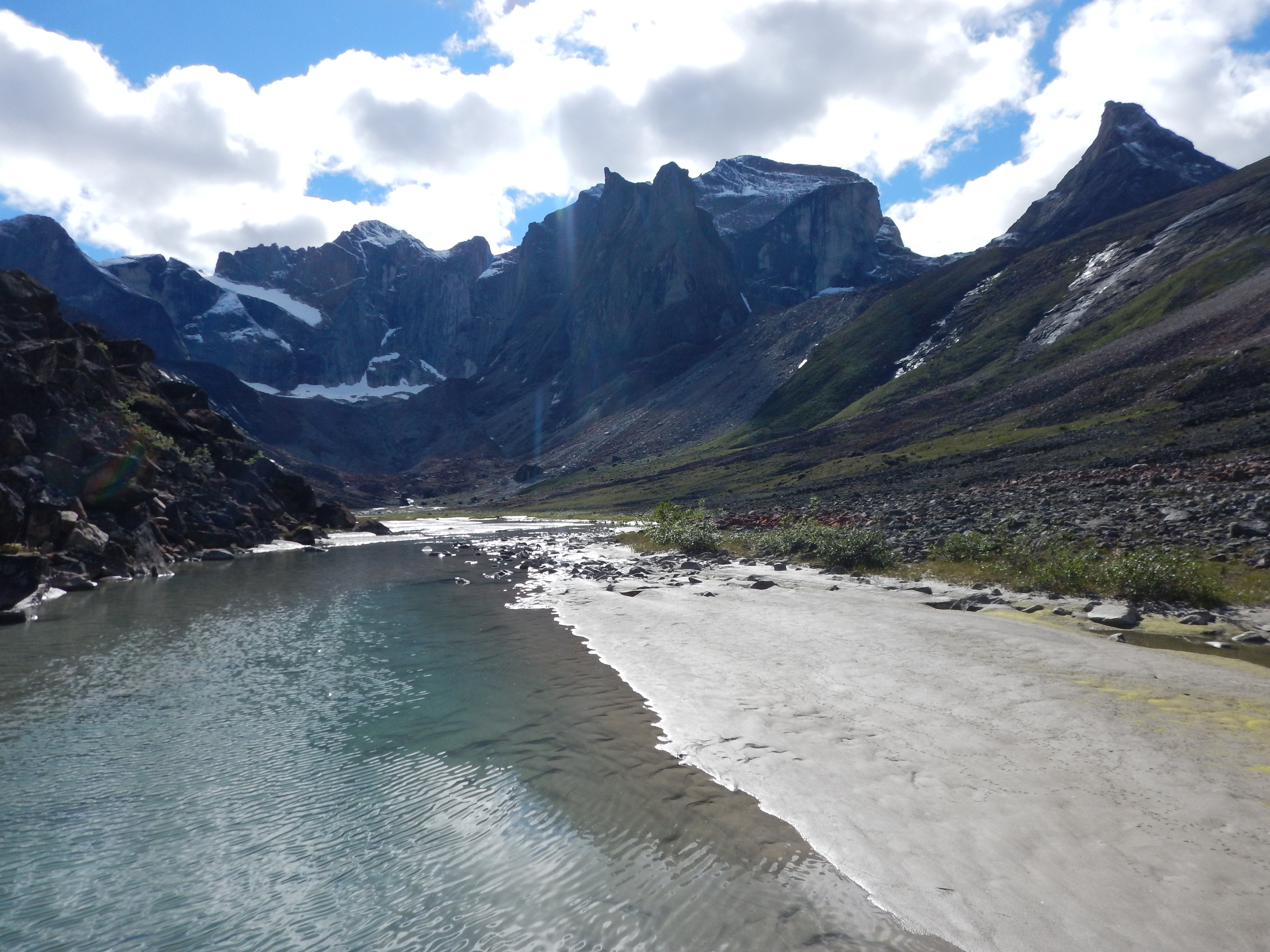
In the upper Arrigetch valley the floor is quite flat, and presents a sequence of pools and meadows.
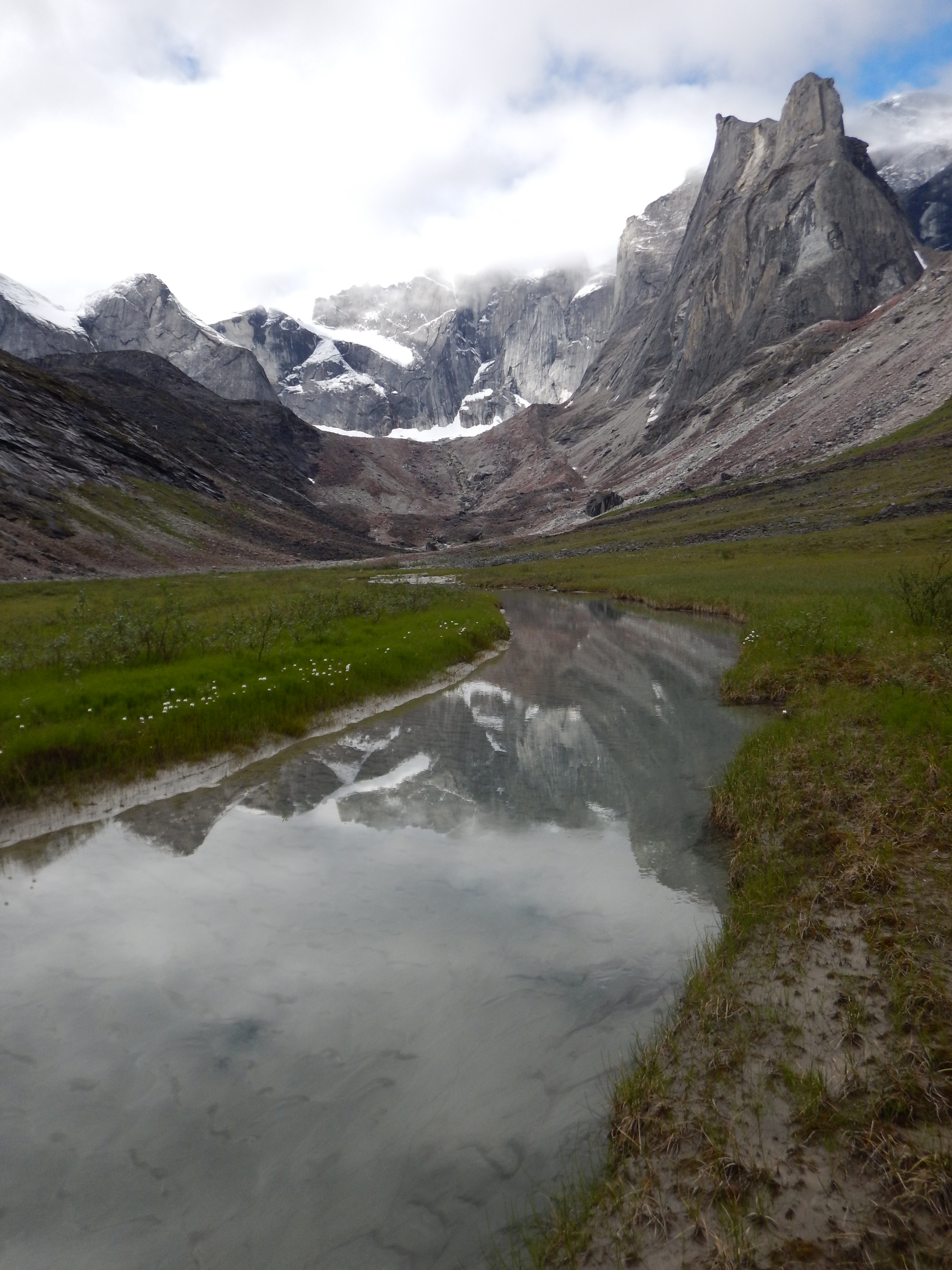
Upper Arrigetch Valley

Eriophorum or Cotton Grass

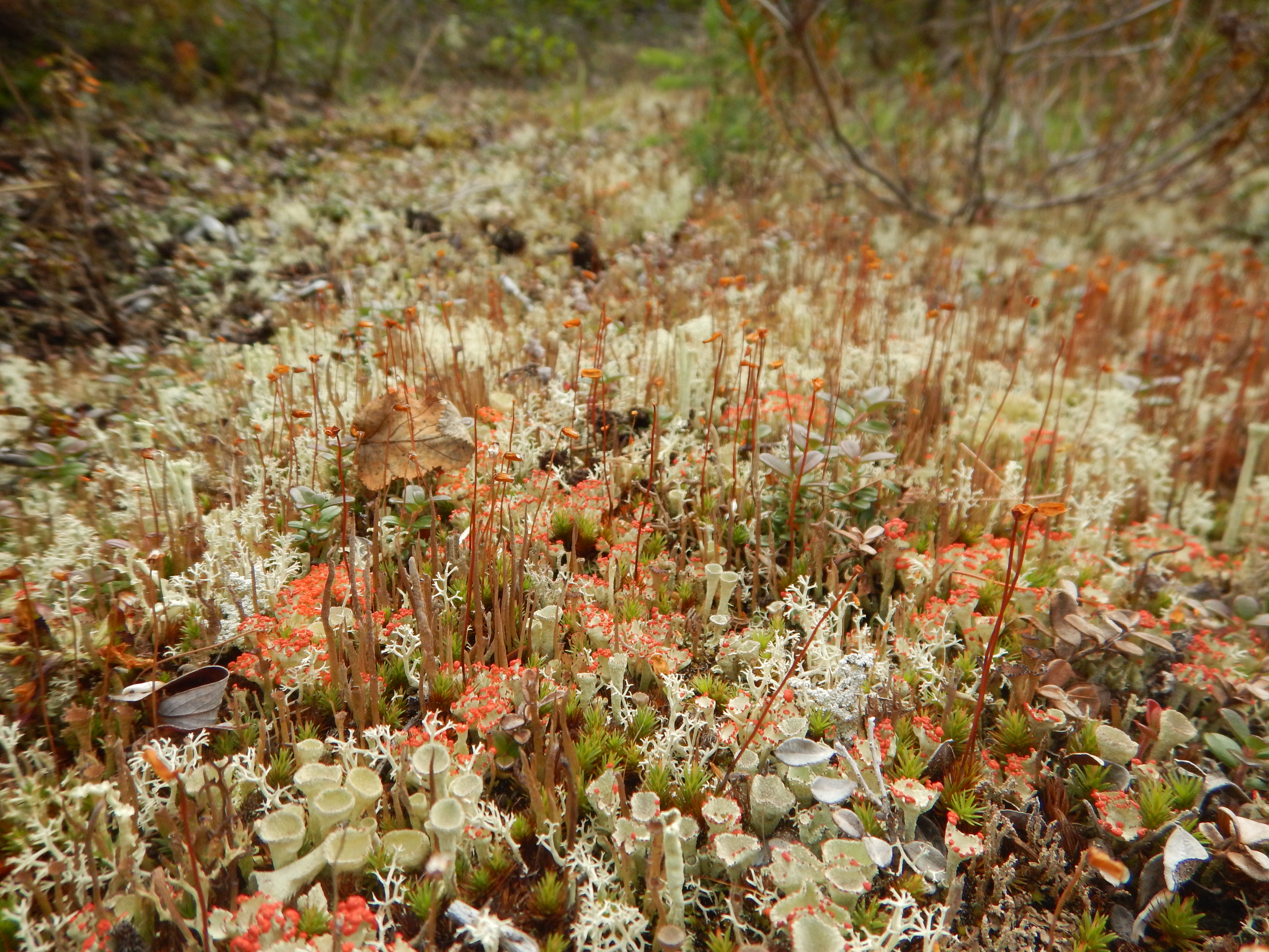
Interesting patterns of lichen on the rocks.
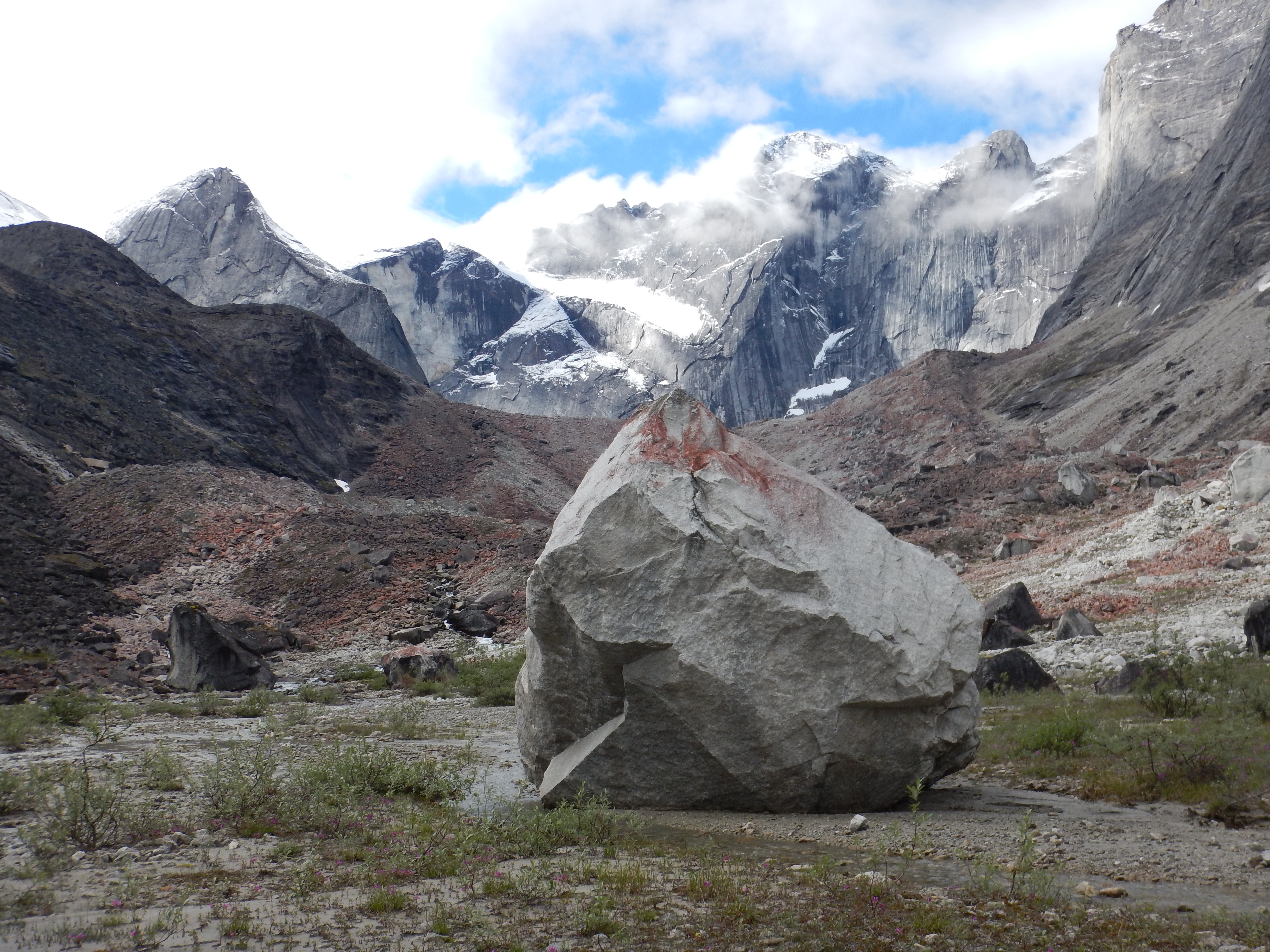
This isolated boulder on the valley floor had come tumbling down from the valley flank in recent years. It was big, maybe 10m across and about 7m high.
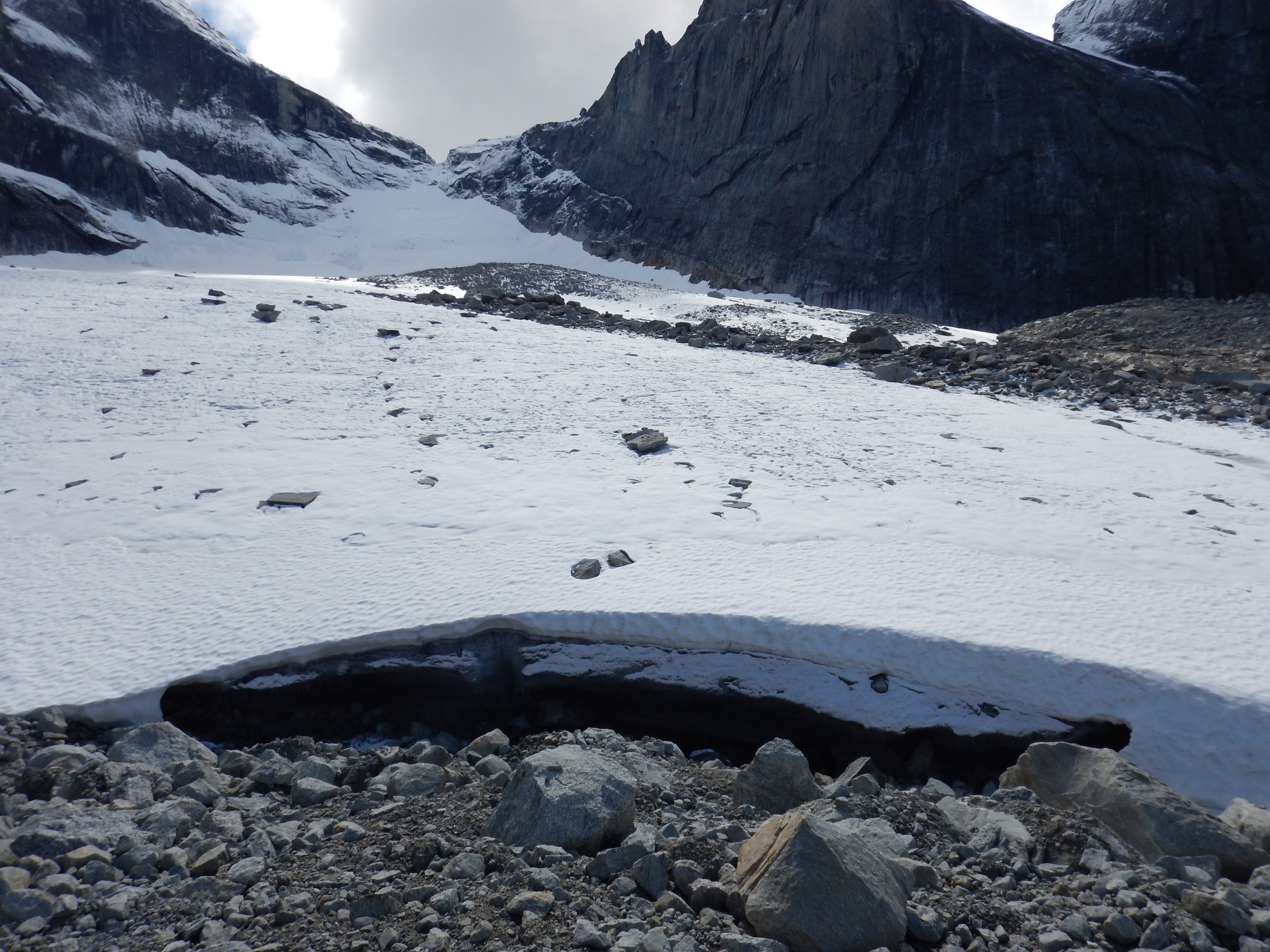
We walked up an old lateral moraine to visit the retreating vestigial glacier at the head of the valley.
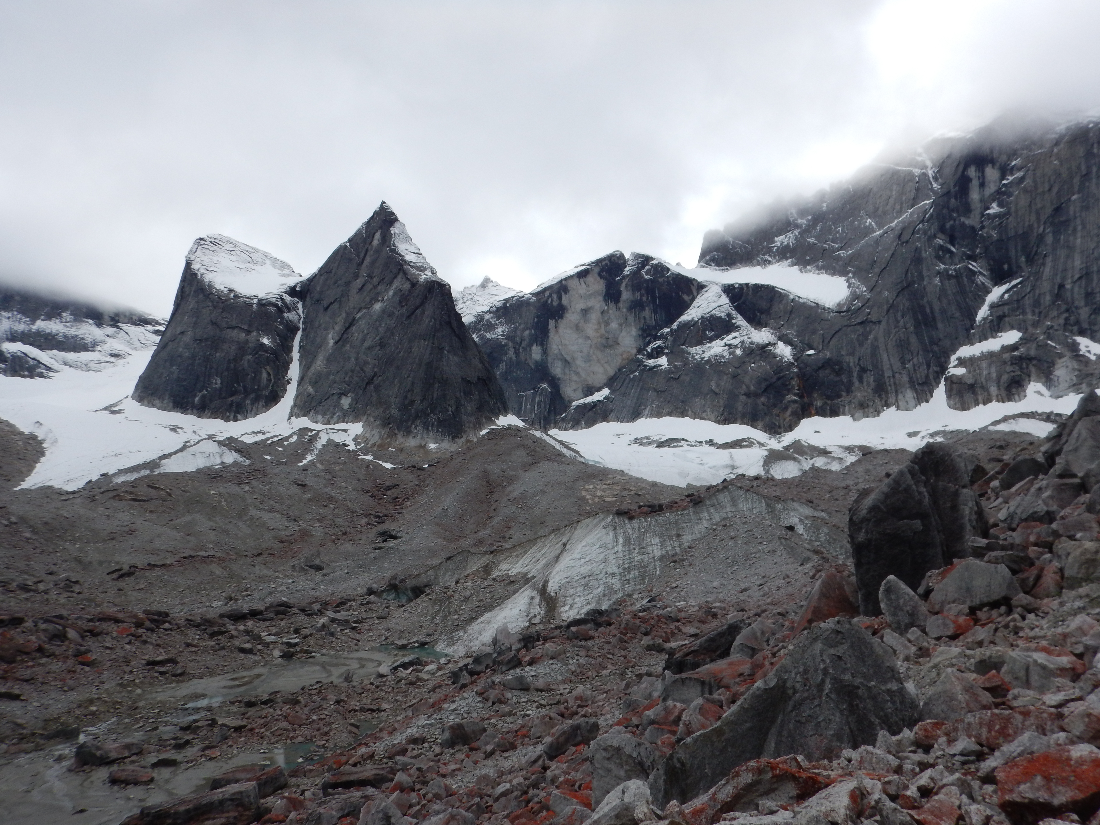
Approaching the glacier.

At the foot of a small glacier.
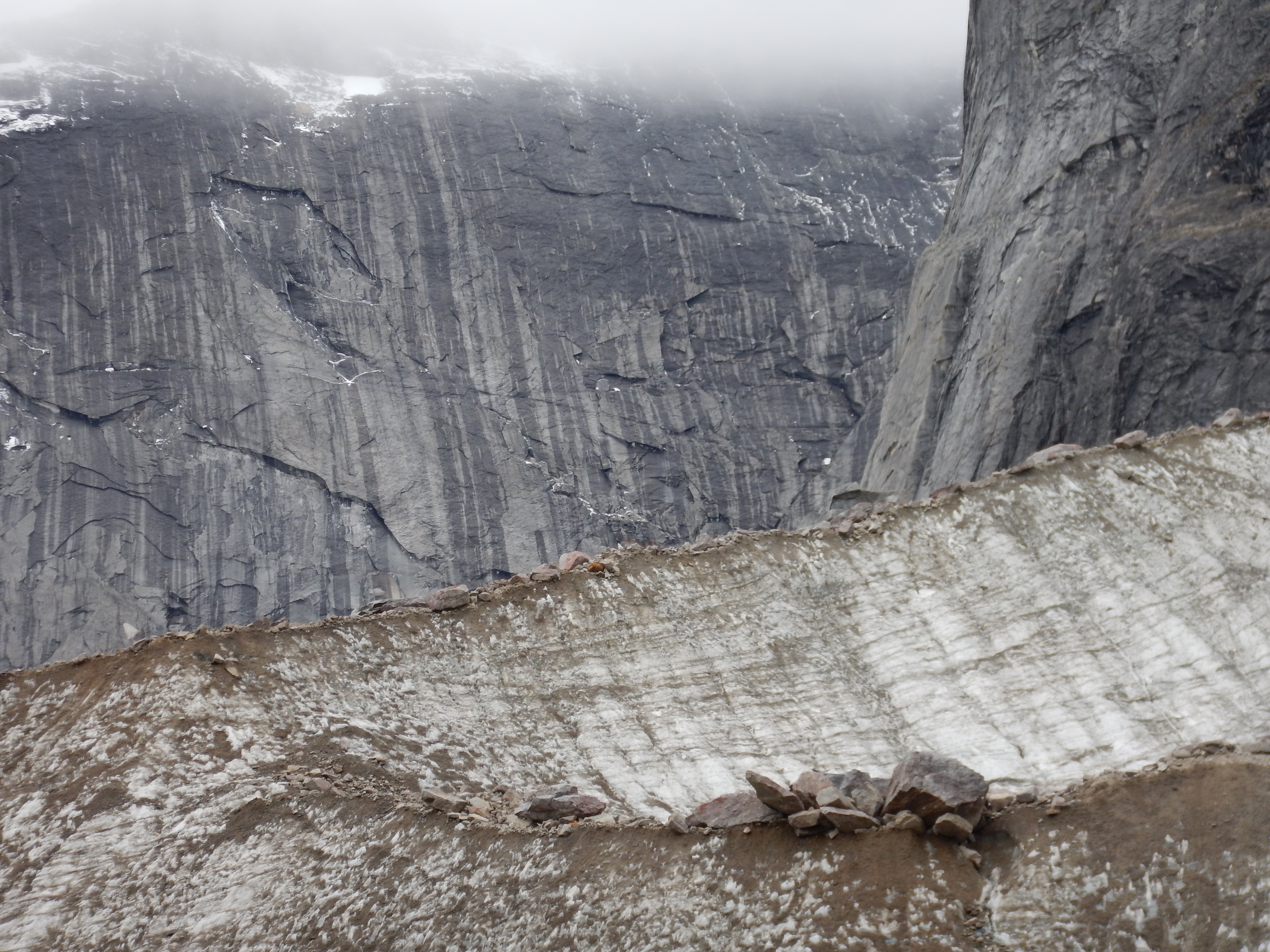
Patterns and textures of ice and stone.

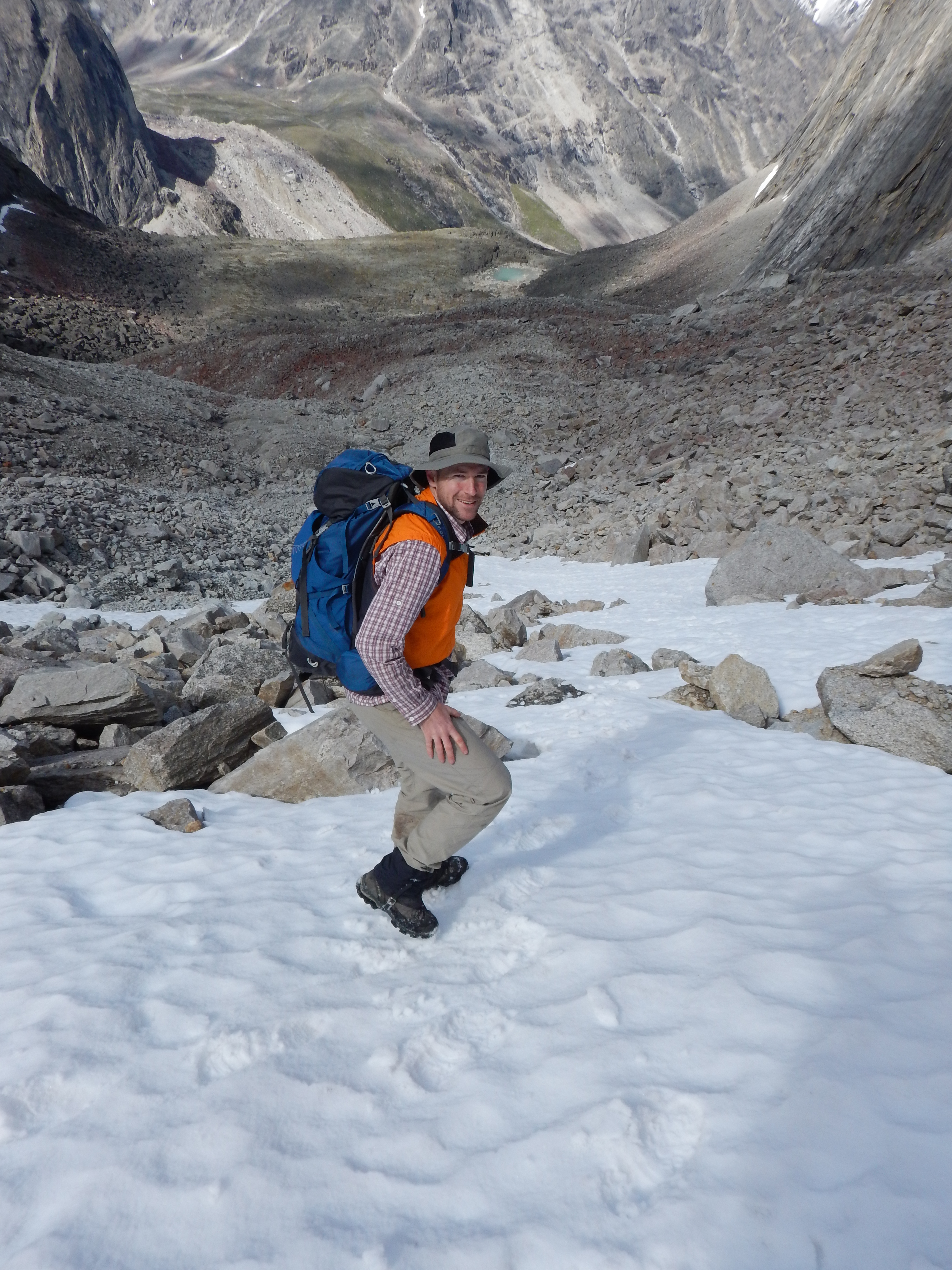
Matt doing what he loves.

Near the head of the Arrigetch valley, looking back down.

Matt under a huge random rock.
Just cruising around on the upper glaciers.
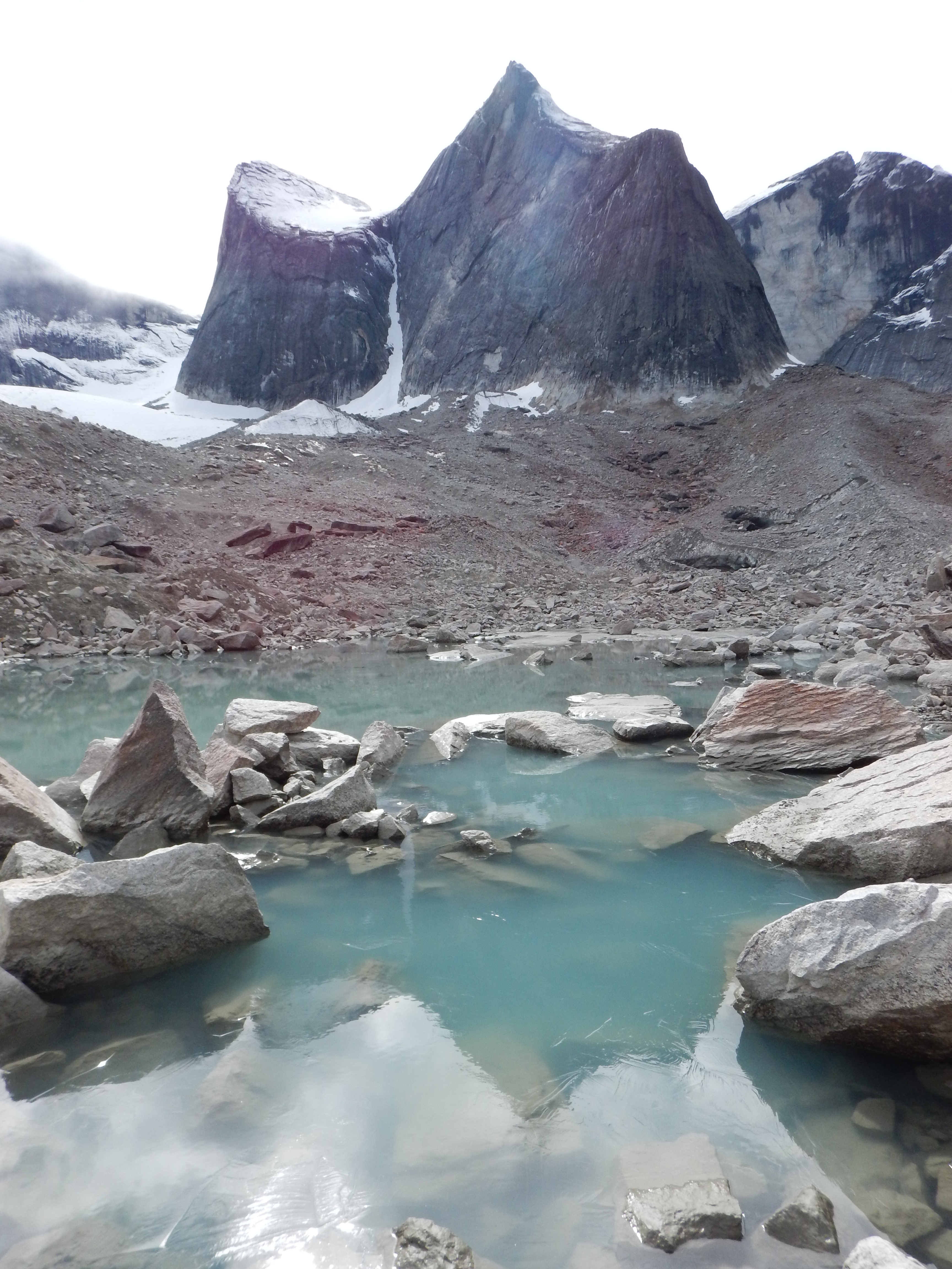
A small tarn.

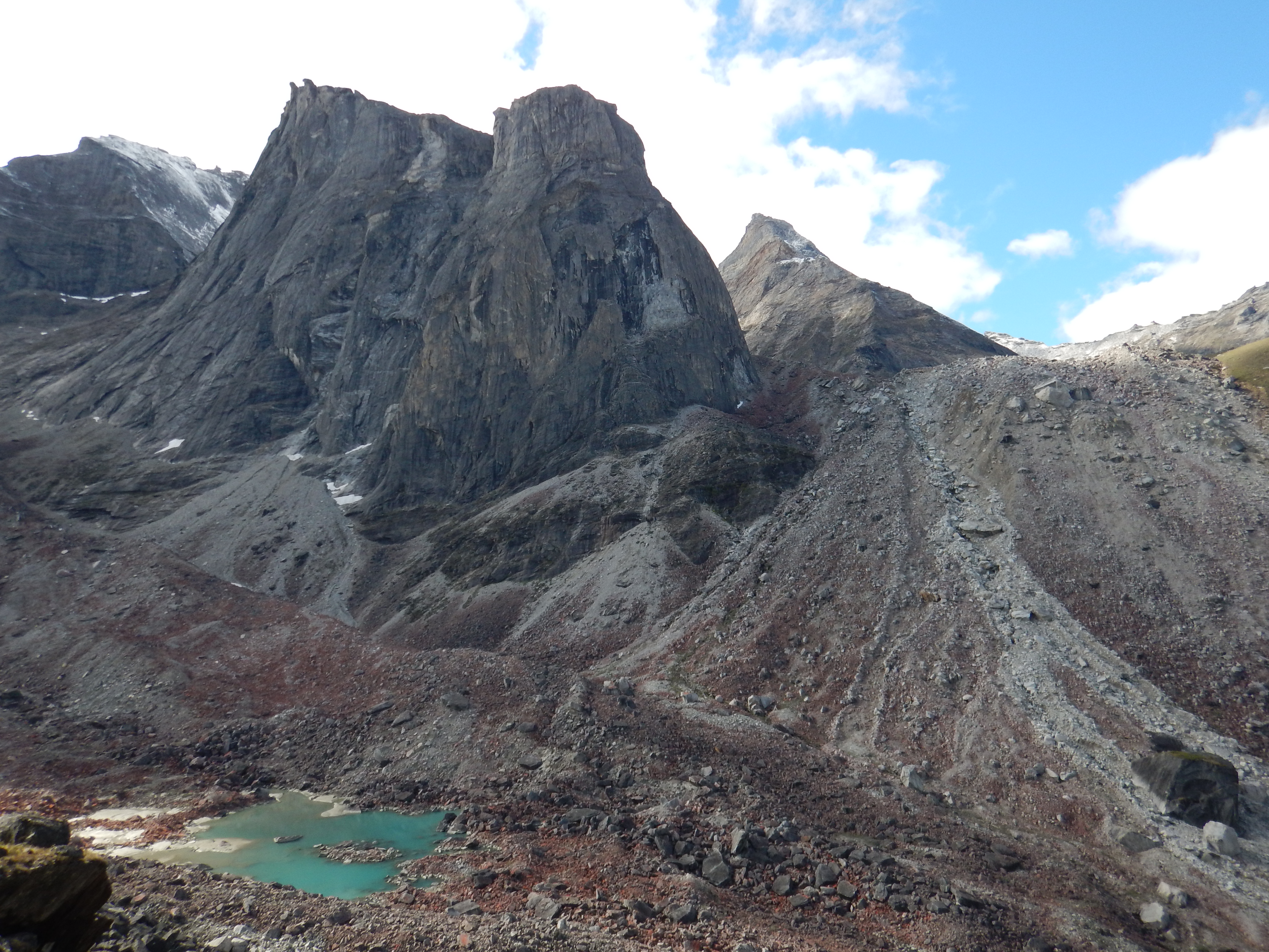
The headwall.

A chain of small tarns in the upper Arrigetch.
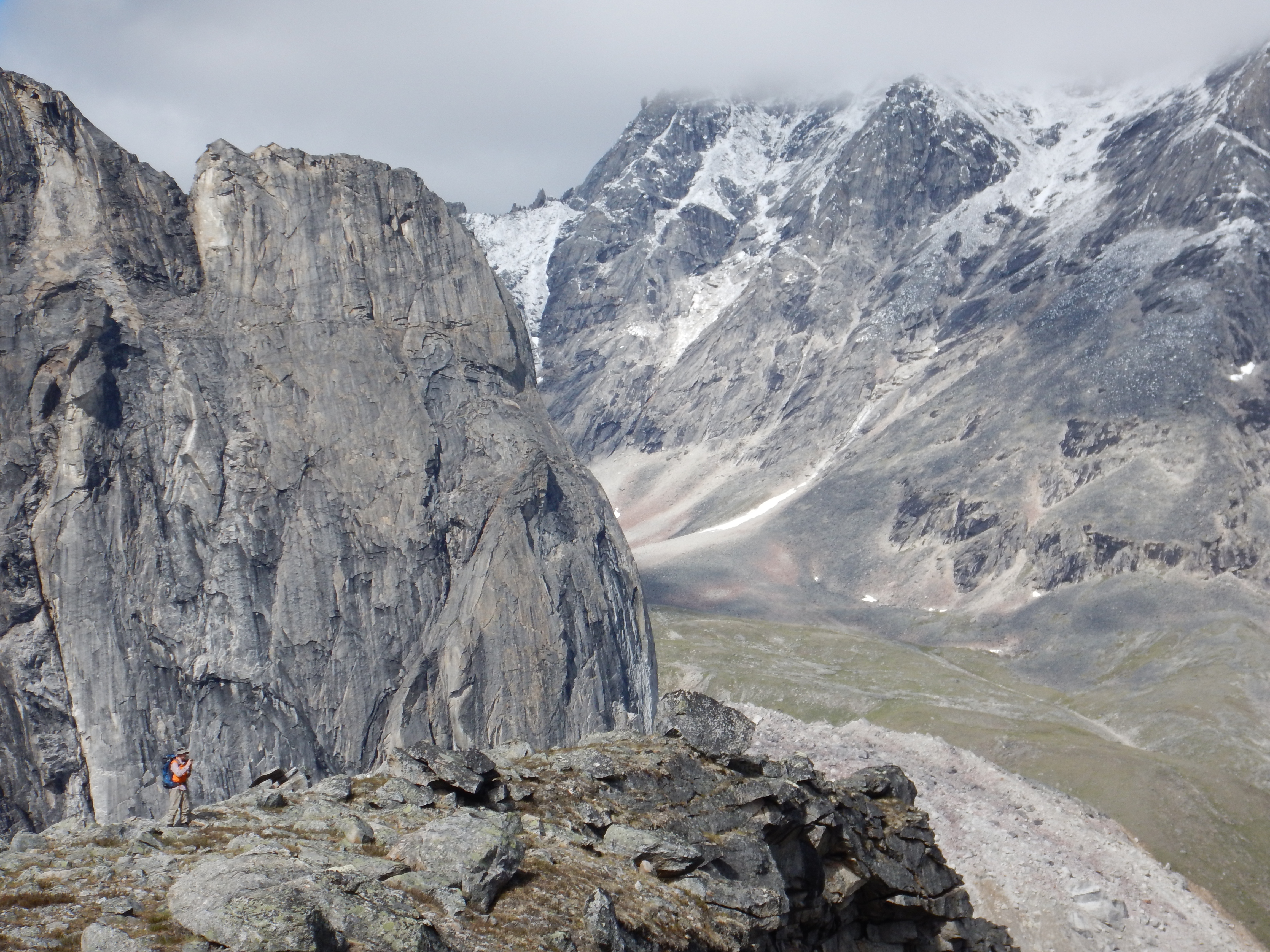
A high vantage point.
To make the day out more interesting, we followed one branch of the valley up to an unnamed col and descended its far side, to return via a different branch of the valley. It was a very interesting and enjoyable diversion.

Good mountains.

Another small glacier.

Pete and Matt practising their craggiest poses.

Pete in extremis on the difficult crags. Or maybe not.
The snout of a small retreating glacier.
Returning to the main valley via a different side valley.

A side valley of the upper Arrigetch.
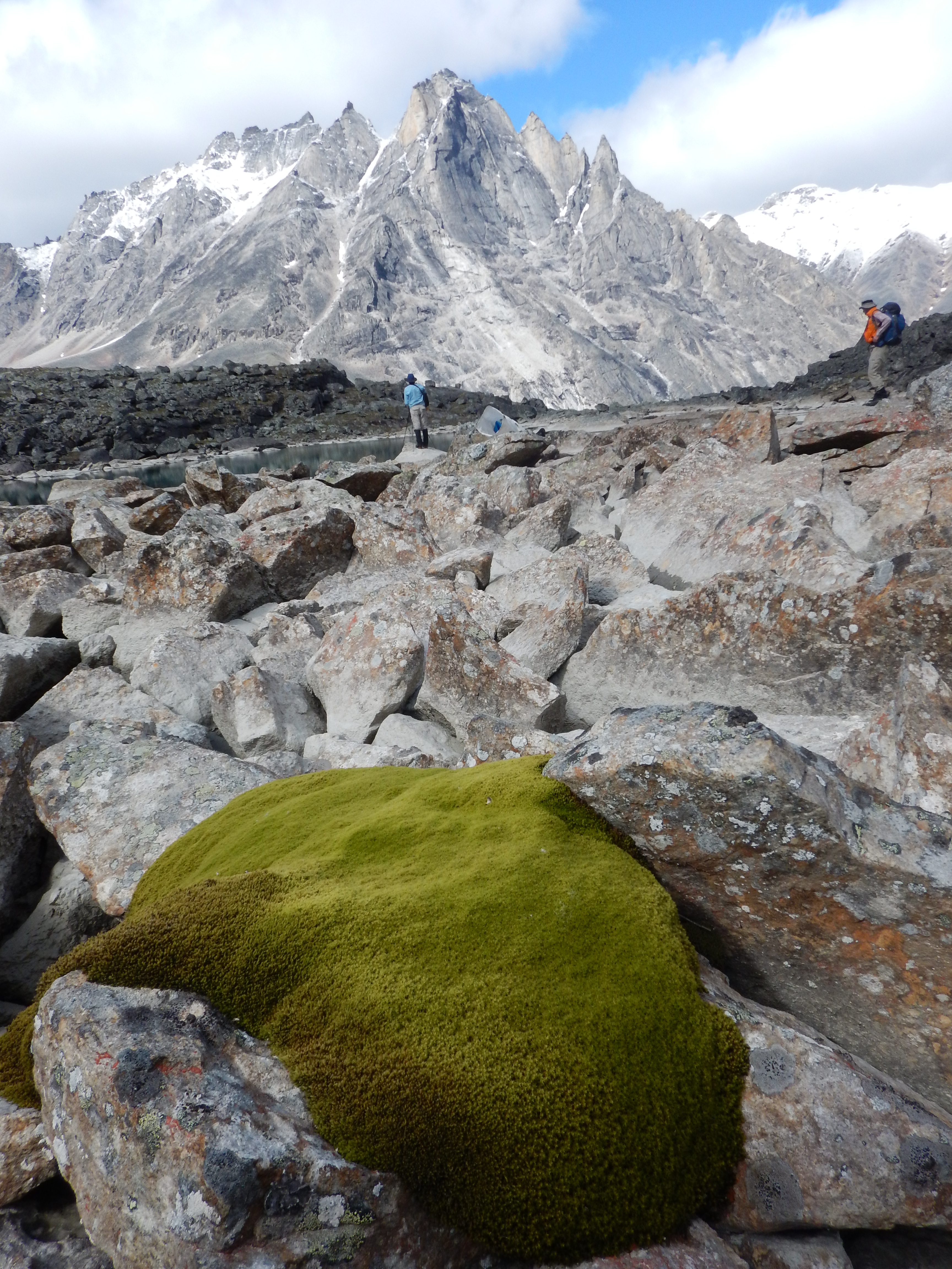
Moss.
Granite glacial geomorphology.
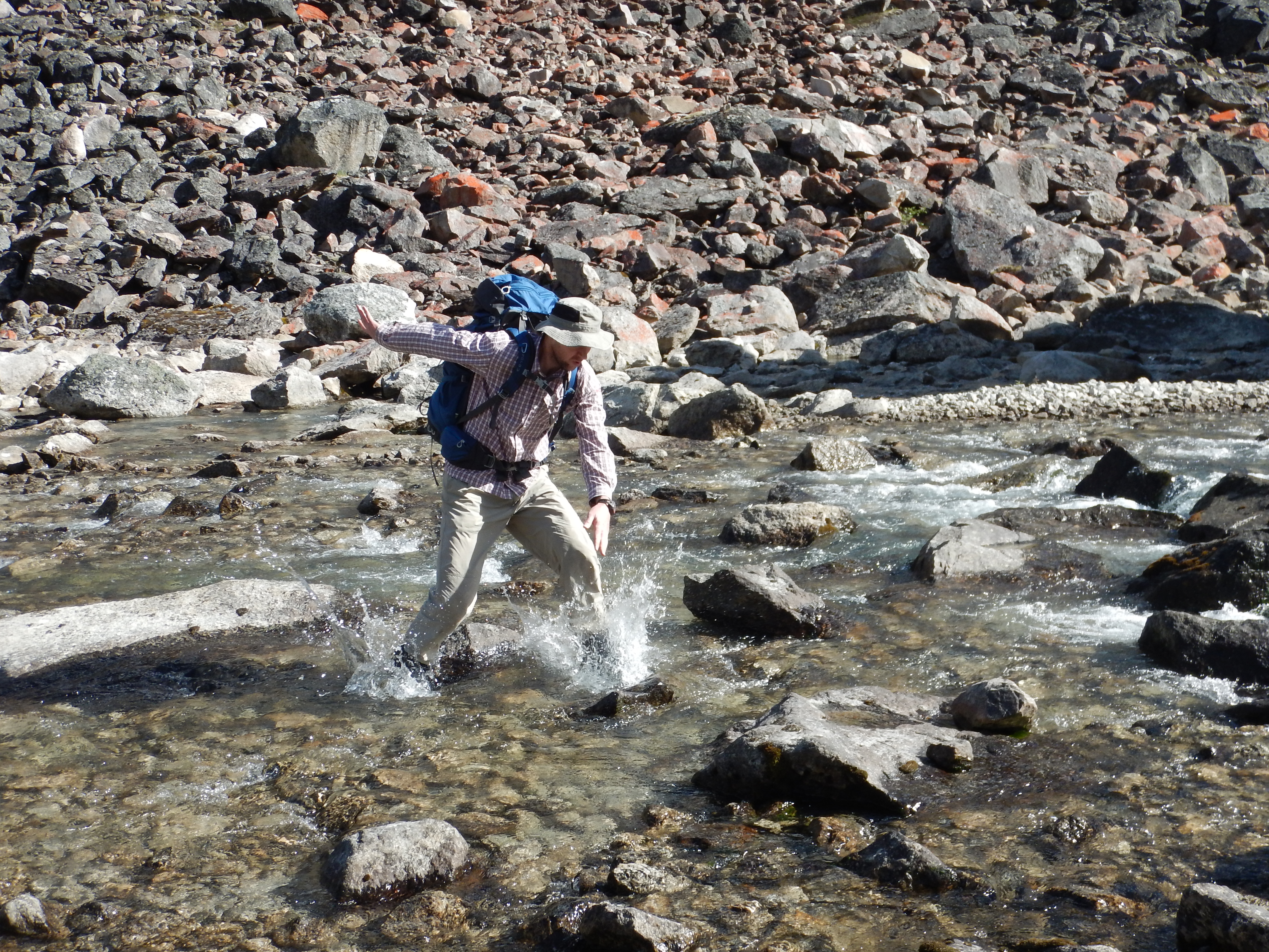
Pete crossing the Arrigetch Creek.
Arrigetch Creek.

Ariel Peak. This is one that we hoped to ascend, as it is apparently often just a steep scramble. The route goes up the right flank, which looked quite plausible, however we could see that the top part was distinctly iced up and dangerous in these conditions. I chose to leave it for next time, but Matt went up to push the line as far as it would safely go. It’s good that he did because he returned with some sensational pictures from about 80% of the way up. Beyond that height, the steep rocks were covered in a thick layer of ice with snow. Without gear to self-arrest, it would have been folly to proceed beyond. (Matt will publish his beautiful pictures on his Irenabyss Gallery website.)

Returning to camp from the upper Arrigetch valley.
Upper Arrigetch
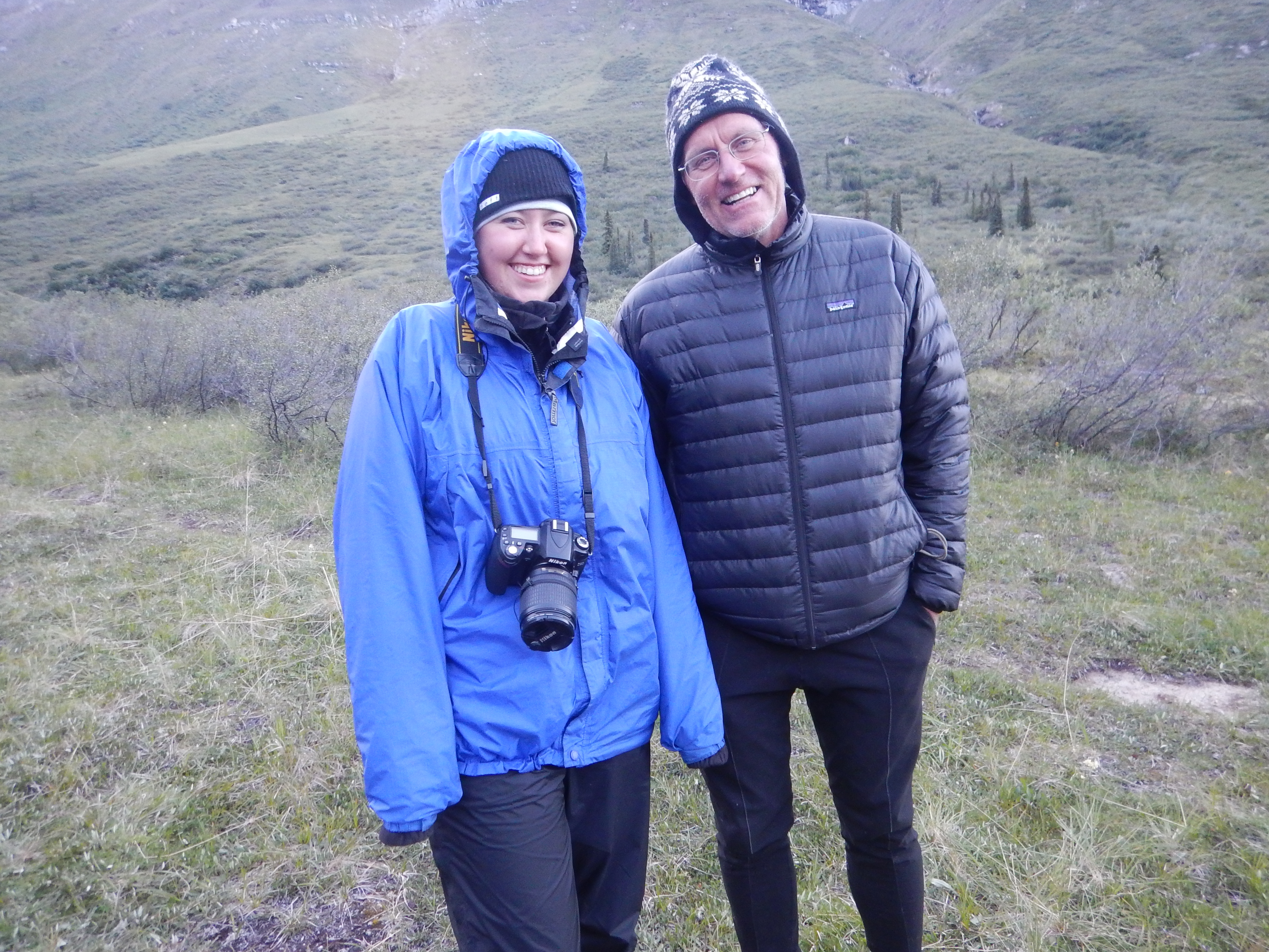
We met these really cool people on Day 7; Allegra and her dad, Dave. They are both really keen mountaineers and paddlers with fantastic stories to tell of adventures past. Allegra is also a very skilful photographer, and was compiling a great set of images of the Arrigetch.
Thus ends Part 2, our scambles in the Arrigetch Valley. If you thought the Arrigetch was beautiful and interesting, check out Part 3, the Aquarius Valley.
Part 3: The Aquarius Valley.


‘Wish I knew what these sweet flowers were.‘ They are Alaska boykinia, and endemic to AK and Yukon. Check it out here https://en.wikipedia.org/wiki/Boykinia_richardsonii